
Portsmouth ZIP Code Coverage
Eight observed USPS-serving ZIP codes appear in Portsmouth research. Their descriptions must stay cautious. The official material supports particular street examples and USPS sorting groups, not a precise neighborhood map for every code. USPS, rather than a city parcel search, is the final check for any complete address. The table identifies the documented examples without turning them into hard delivery boundaries.
| ZIP Code | Areas Covered | Post Office | Notes |
|---|---|---|---|
| 23701 | Western/southern examples, including Portsmouth Boulevard and Crawford-area addresses | PORTSMOUTH VA 23701 sort group | Exact delivery boundary was not located; verify each address |
| 23702 | East/southeast examples, including Alden Avenue, Monmouth Street, Gillis Road, and Greenwood Drive | PORTSMOUTH VA 23701 sort group | Examples are not a boundary map |
| 23703 | Churchland and river-side examples, including Pine Bark Road, Academy Avenue, River Shore, Michael, and Hedgerow | PORTSMOUTH VA 23705 sort group | Neighborhood inference is approximate |
| 23704 | Central/downtown examples, including Effingham, London, Lansing, Portsmouth Boulevard, and Elm | PORTSMOUTH VA 23701 sort group | Not all downtown streets use the same code |
| 23705 | Portsmouth USPS sorting and central postal geography | PORTSMOUTH VA 23705 sort group | Precise standard or PO-box distinction was not located |
| 23707 | North/central residential examples, including Shenandoah, Mount Vernon, North, Westhaven, and Hartford | PORTSMOUTH VA 23705 sort group | 443 Maryland Ave is documented as 23707-2119 |
| 23708 | USPS-listed Portsmouth code; exact local area was not located | PORTSMOUTH VA 23705 sort group | Do not infer a PO-box or institutional type |
| 23709 | USPS-listed Portsmouth code; exact local area was not located | PORTSMOUTH VA 23705 sort group | Do not infer a PO-box or institutional type |
The Portsmouth ZIP code directory therefore works as an address-verification aid, not a substitute for USPS delivery standards. Neither 23708 nor 23709 has a documented local type in the official sources reviewed. Do not label either as a PO-box, unique, or institutional code without a current USPS result.
Portsmouth ZIP Code Sort Groups
USPS DMM L012 groups Portsmouth sorting names in two clusters. Codes 23701, 23702, and 23704 sort to PORTSMOUTH VA 23701. Codes 23703, 23705, 23707, 23708, and 23709 sort to PORTSMOUTH VA 23705. A sorting designation is useful postal context, but it does not identify a neighborhood edge, the government that serves a parcel, or a person at that address.
That distinction matters in an independent city. Portsmouth is its own county-equivalent locality, while its mail is part of a delivery system that does not follow city lines. Keep the ZIP code result, the city boundary, and the parcel address as separate pieces of information. The Census boundary reference can confirm the city line, while USPS confirms a delivery address.
Confirm a Portsmouth ZIP Code With USPS
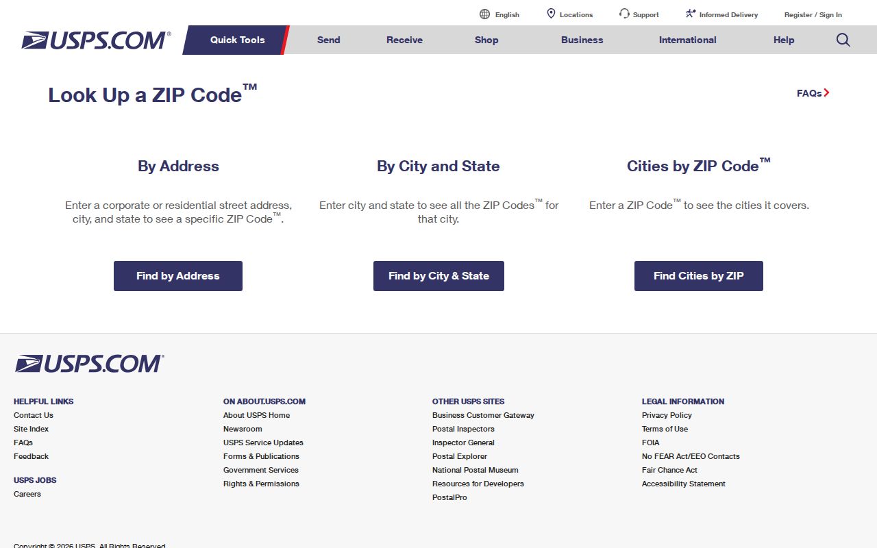
The USPS ZIP Code Lookup is the official final check. Its service has By Address, By City and State, Cities by ZIP, and FAQ tabs. By Address standardizes delivery information. USPS warns that a result does not confirm that a person or company is at an address, which is why it belongs at the address-verification stage rather than the identity stage.
| USPS field or mode | Use |
|---|---|
| By Address | Checks a known delivery address |
| Street Address | Primary street-address field for the address mode |
| City and State | Required locality inputs for the address route |
| Company | Optional additional address detail |
| Apt/Suite/Other | Optional unit or secondary-address detail |
| ZIP | Optional field in address mode; primary field in Cities by ZIP |
| Find | Runs the selected lookup |
The official USPS lookup displays the address, city/state, and ZIP entry choices used for a delivery check.
Use the standardized result as the postal value to record. It does not create a ZIP-wide resident list, establish parcel ownership, or prove that a named person receives mail there.
Portsmouth ZIP Code Search Limits
Portsmouth’s visible assessor interface searches by street, recent sales or neighborhood, map-and-parcel, and map. It does not expose a ZIP field or a visible owner-name field. The GIS viewer can display address points and parcels, but the research did not document a ZIP search or filter in the public viewer. A ZIP code is therefore a poor starting field for city property research.
Virginia’s voter lookup is also person and status oriented, not ZIP-wide. Voter lists have statutory recipient, purpose, protected-address, and non-publication limits. A postal delivery code cannot be used to infer a public household roll from either the assessor or voter system.
Find Portsmouth Addresses by ZIP Code
A ZIP code can narrow a known address check, but it cannot produce an official list of Portsmouth residents. Start with the full street address and confirm the postal code through USPS. Then use the city’s address-oriented tools to connect that physical location to a parcel. The assessor and GIS do not provide a documented ZIP-wide mode, so the workflow moves from a confirmed address to the relevant city record rather than from a ZIP to names.
- Enter the complete known street address in USPS By Address and record the standardized ZIP and ZIP+4 result.
- Search the Portsmouth assessor by the street number, street name, separate suffix, or map-and-parcel value. Do not expect a ZIP field or a name directory.
- Open the Portsmouth GIS viewer for the confirmed address or parcel and compare the address point, parcel boundary, street context, and public popup fields.
- Use the parcel’s map/parcel and legal description for a recorded-deed question, not the ZIP code alone.
- For a historical address, compare the publication-year directory entry with the street address and record its year, since it is an occupant clue rather than a current delivery confirmation.
Once the address is confirmed, the Portsmouth street directory lookup has the fuller street and parcel workflow. The postal result should remain a separate check, particularly when a street runs near a local boundary.
Portsmouth ZIPs and City Limits
A ZIP code is USPS delivery geography. Portsmouth’s municipal boundary is a different geography, and the Census BAS map for independent-city FIPS 51740 is the official reference for that boundary. Portsmouth is compact, bounded by water, and adjoins Norfolk, Chesapeake, and Suffolk. A mailing address near one of those lines still needs an exact USPS check rather than a conclusion based on a ZIP label.
Postal check. Use USPS to validate the delivery address and a city boundary source to validate the locality. Neither result identifies every record custodian for a parcel.
Portsmouth Situs and Mailing Fields
Address fields in Portsmouth records should not be substituted for each other. An assessor card is about the parcel. A deed uses a legal description. A historical directory records an occupant or business connection in a publication year. USPS standardizes delivery information. Keeping the field label with each result prevents a mailing address, tax parcel, and old directory line from being treated as the same fact.
- ZIP code and ZIP+4
- A ZIP code identifies a postal delivery area. ZIP+4 adds a more specific delivery segment to the five-digit code.
- PO box ZIP
- A code used for a post-office-box delivery arrangement. The Portsmouth research does not establish which local codes, if any, have that type.
- Carrier route
- A postal delivery sequence or route used in mail handling. It is not a city boundary or a resident list.
- Situs address
- The physical location of a parcel.
- Mailing address
- The address used for tax notices or correspondence, which can be outside the parcel or city.
Historic Context for Portsmouth ZIPs
Older Portsmouth address research requires a date as well as a ZIP check. Portsmouth was incorporated as a city in 1858, while Park View was annexed in 1894. Cradock and Truxtun developed around 1918 to 1920 in the World War I shipyard-expansion era. Those facts can help select the right directory, map, or deed period, but they do not establish a modern ZIP boundary for any historic district.
For a historical street address, use the publication year on a city directory and compare it with the street layout from the appropriate map or record series. Modern postal codes should be verified from the current address, not projected backward onto an old directory entry. The research did not locate an authoritative citywide renumbering table, so avoid making a year-specific renumbering claim.
Portsmouth Voter ZIP Limits
Virginia’s Citizen Portal offers individual registration-status and election services, not a search for everyone in a ZIP code. Public inspection and copies of voter lists are controlled by Virginia Code §§24.2-405 and 24.2-444. Protected addresses and statutory recipient rules apply, and a recipient may not publish a voter list online or in a searchable public database.
A postal code may help confirm the form of a known address, but it does not make voter information a ZIP-wide residents directory. For lawful election information, use the person-specific state service or contact the Portsmouth registrar for the proper local route.
Portsmouth ZIP Code Boundary Checks
ZIP codes and city limits answer different questions. USPS assigns delivery geography and can standardize an address. The Census BAS map identifies the Portsmouth independent-city boundary and adjacent Norfolk, Chesapeake, Suffolk, and waterways. A Portsmouth ZIP code should never be reverse-engineered into a city-limit map, and a city parcel should never be assigned a code by neighborhood assumption.
The most careful approach is simple: verify the postal address with USPS, verify the physical parcel through the city assessor or GIS, and use the record custodian that holds the document needed. If the fields disagree, preserve each source’s label and date rather than forcing them into a single address history.
- Delivery city
- The city name USPS uses in a delivery address. It is not always the boundary of a local government.
- Map/parcel
- The assessor and GIS identifier for a parcel. It is a property key, not a postal code.
- Legal description
- The deed’s formal land description, which may use a lot, block, subdivision, or metes-and-bounds wording.
Note: A ZIP result standardizes mail delivery, while a parcel record and a city boundary source address separate geography questions.